- Grid Generation Tool—This tool allows the user to generate a grid of points to be sampled in a forest stand on their GPS-equipped handheld. The GPS will tell the user how to get to the point; once he’s there, a software interface will call up the timber inventory program so the user can enter measurements on the trees in that plot area. Once all the tree measurement data is collected, SOLO Forest calls up the next plot location on the grid to be sampled, with navigational tools to get the user there. It also marks completed plot points so the user knows when he’s visited all of the points on the grid.
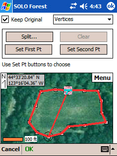
- Split/Merge Polygon Tool—When collecting data in a forest stand, a user will often find an area that needs to be treated separately because of differences in tree size, species or other factors. With the split tool, a user can map out a separate plot area using GPS or from a map display on the handheld. The merge tool does the opposite when two areas have the same kind or size of trees.
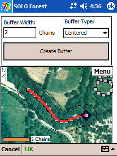
- Buffer Tool—Many areas require a buffer zone along streams, rivers or wildlife habitats where trees cannot be cut. The buffer tool allows a user to define that zone around a point, line or area. Like the split/merge polygon tool, the buffer tool lets a user define the area using GPS or a map on the screen.


Besides the product demonstration, I also had opportunities to talk with customers and answer their questions. They’re familiar with electronic maps and GIS, but the most common questions were about how SOLO Forest handles different GIS file formats. Fortunately, I could tell them that it works with ESRI Shapefiles, along with projection information, AutoCAD DXF and other common files.
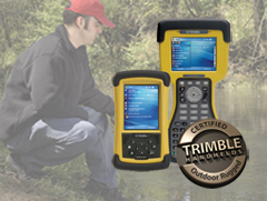
Forestry is one of those outdoor environments where rugged handhelds are proving very popular. With today’s software, mapping and GPS capabilities, they’re practical tools that can help foresters get more accurate data and do it more efficiently.


No comments:
Post a Comment