


BIG NEWS
We've moved to OutdoorRugged.com
For more blogs, videos and a new forum, it's the place to be for outdoor professionals.
Wednesday, May 30, 2007
Wednesday, May 2, 2007
Get a little bit more from your GPS
Have you ever wanted to see the status of your GPS in an easy-to-use interface? I recently found a great application for your GPS-enabled Recon or Ranger called Visual GPSce. The program is available via VisualGPS.net, and it’s a free download.
What I like best about this little program is its simplicity. After downloading the application, all I had to do was set the serial port to COM4 (the Microsoft GPS sharing port), and the data started flowing in.
The first screen shows the traditional signal strength indicators:

The second screen shows an advanced satellite plot page with the predicted paths of each satellite:

The third screen shows an innovative dashboard with common cockpit-style indicators for speed, altitude, direction, and vertical speed:

The final screen could be the most useful to some people. It shows statistical averages of position with standard deviation and least squares average:

In short, this little program gives you the information you need from your GPS without being difficult to configure. Out of all the status applications I have tried (including the application that ships with the Holux GPS card), this is the one I keep coming back to because I know it will always work.
If you like this app, Visual GPS also makes a more advanced program, BeeLineGPS, that’s $29.95 with a 30-day free trial.
Tuesday, April 17, 2007
Portland Police use rugged handhelds to write electronic tickets

Just like police cars that are beefed up with heavy-duty components, the Recon rugged handheld is built to withstand the rigors of police work. Officers in Portland, Ore. use the handhelds for writing electronic tickets, dispatch and for real-time connections to motor vehicle, National Crime Information Center (NCIC) and other databases. Using the handhelds, officers save time on traffic stops and have improved the accuracy of traffic citations.
http://www.trimble.com/pdxpolice
Friday, April 13, 2007
Denver Fire Department saves 4,000 hours a year using rugged handhelds for fire safety inspections

The Denver Fire Department is able to capture three times as much information, saves 4,000 labor hours a year, and has eliminated about 60,000 sheets of carbonless paper by conducting its fire safety inspections using a rugged Recon handheld.
www.trimble.com/denverfire
Wednesday, April 11, 2007
Erasing battery memory effect
Unlike older NiCad batteries, which suffered from shortened battery life after multiple partial discharge cycles, the Recon’s NiMH batteries are generally not susceptible to this “memory effect.” Still, we’ve had some calls from customers reporting that the low battery warning is showing up much earlier on their Recons.
Jan Gallant from our tech support department looked into the problem, did some tests, and has a solution: a deep discharge of your Recon’s battery, followed by a full 12-hour recharge. Details are in this product bulletin
Tuesday, April 3, 2007
Rugged from the inside out
There’s much more to building a rugged handheld than putting a sturdy case around a commercial-grade PDA. And while all our handhelds meet the MIL-STD-810F military standard for durability and come with an IP67 rating against water and dust, we design and test them to withstand a lifetime of real-world customer use, not just to meet a spec.
Jerry Steiger, a mechanical engineer who has worked on three generations of our rugged handhelds, shows how they’re built tough from the inside out. You’ll also see how the designs have evolved to save weight and reduce costs while not compromising ruggedness.
Thursday, March 29, 2007
New GPS card keeps you from going in circles
Since we started shipping the new Holux GR-271 GPS CompactFlash card a couple of months ago, I have wanted to test it out in a real-world situation. The new Holux card, which uses the SiRF Star III chipset—is supposed to not lose signals under tree cover. That was a common problem with the chipset used in an earlier GPS card.
I set out to test whether a Recon equipped with this new card will show the improved reception. Finding tree cover is something that is easily done in the mountains of Western Oregon. To conduct the test, I set up two identical Recon X-Series units with extended caps and TDS TerraGuide software. I installed the new Holux GR-271 GPS card in one and an older Holux GPS card in the other.
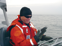
 For the test location, I picked the most rugged terrain with dense tree cover, Old Growth Trail, near Corvallis. Not only does this trail go through a steep valley with limited view of the sky, but it also goes through a stand of 250 year-old trees that absorb faint GPS radio signals. I walked the route with both units running side-by-side so they would experience the same conditions. As you can see from the photo above, it was raining the entire trip.
Here’s a screen shot from TerraGuide of the trip. The new Holux GPS is colored green and the old Holux GPS is colored red.
 Although the aerial photo is about 25 years old (the clear-cut area in the top left is now covered with trees), you can see that the route starts on a forest road and then turns off into an area with large trees. The new Holux GPS showed a satellite fix for the entire trip, while the older GPS only showed a fix for about half the trip.
Looking closely at the tracks above you can see that the Holux GR-271 GPS closely follows the road (white in the photo), while the old GPS wanders 50 to 100 feet from the mark. When you reach the large trees this situation gets even worse. You can see that the old card only got a couple fixes on the trail (visible as long straight lines), while the new card got a fix every 10 feet (shown by smooth contours in the track). In some places (near the far right), spurious fixes actually showed the track looping itself—something the trail certainly did not do.
Although this is only one real-world test, the new Holux GPS appears to record tracks much better than the old card. With any luck, this will translate into better performance of the Recon with GPS for outdoor navigation, GIS mapping and forestry applications (like TDS SOLO Forest). At least it will keep you from going in circles.
I set out to test whether a Recon equipped with this new card will show the improved reception. Finding tree cover is something that is easily done in the mountains of Western Oregon. To conduct the test, I set up two identical Recon X-Series units with extended caps and TDS TerraGuide software. I installed the new Holux GR-271 GPS card in one and an older Holux GPS card in the other.
 For the test location, I picked the most rugged terrain with dense tree cover, Old Growth Trail, near Corvallis. Not only does this trail go through a steep valley with limited view of the sky, but it also goes through a stand of 250 year-old trees that absorb faint GPS radio signals. I walked the route with both units running side-by-side so they would experience the same conditions. As you can see from the photo above, it was raining the entire trip.
Here’s a screen shot from TerraGuide of the trip. The new Holux GPS is colored green and the old Holux GPS is colored red.
 Although the aerial photo is about 25 years old (the clear-cut area in the top left is now covered with trees), you can see that the route starts on a forest road and then turns off into an area with large trees. The new Holux GPS showed a satellite fix for the entire trip, while the older GPS only showed a fix for about half the trip.
Looking closely at the tracks above you can see that the Holux GR-271 GPS closely follows the road (white in the photo), while the old GPS wanders 50 to 100 feet from the mark. When you reach the large trees this situation gets even worse. You can see that the old card only got a couple fixes on the trail (visible as long straight lines), while the new card got a fix every 10 feet (shown by smooth contours in the track). In some places (near the far right), spurious fixes actually showed the track looping itself—something the trail certainly did not do.
Although this is only one real-world test, the new Holux GPS appears to record tracks much better than the old card. With any luck, this will translate into better performance of the Recon with GPS for outdoor navigation, GIS mapping and forestry applications (like TDS SOLO Forest). At least it will keep you from going in circles.
Subscribe to:
Posts (Atom)